

Driving the Nullarbor: the essentials
The Eyre Highway runs roughly 1,200 kilometres between Norseman in Western Australia and Ceduna in South Australia, and most people add the Goldfields or Eyre Peninsula legs either side. It is a sealed, well-used road and a perfectly ordinary family car will manage it — but the distances between help are long, so a little preparation goes a long way. These are the things the Nullarbor Net crew tells friends before they set off. For everything in one place, read our complete guide to crossing the Nullarbor.
Fuel and roadhouses
Across the Plain there are no towns in the usual sense, just roadhouses spaced anywhere from about 60 to nearly 200 kilometres apart. Fill up whenever you pass one rather than running the tank low, and expect fuel to cost noticeably more than in the cities. Not every roadhouse is open 24 hours, so if you plan to push on into the evening check opening times on the individual town pages first. For every fuel stop and the distance between them, see Nullarbor fuel stops and distances. Driving an electric car? See EV charging on the Nullarbor.
Water, food and phones
Carry more drinking water than you think you need — at least several litres per person — plus snacks, in case of a breakdown in summer heat. Mobile coverage is patchy: expect signal near the roadhouses and long stretches with none in between, and Telstra generally reaches further than other networks. For remote side trips, a satellite messenger or personal locator beacon is worth considering. For hospitals, Centrelink and crisis lines along the route, see our help and support page.
Quarantine checkpoints
Both states run agricultural quarantine checks on the highway. Heading west, the Western Australian checkpoint is at Border Village; heading east, South Australia's is at Ceduna. Fresh fruit, vegetables, honey and some plant material will be taken off you, so plan your shopping to eat it up before you reach them. The Border Village and Ceduna pages have more detail, and our quarantine rules page lists what you can and can't take.
Time zones
Clocks change as you cross. South Australia runs on Central time, Western Australia on Western time, and the roadhouses between the border and Caiguna use their own unofficial “Central Western” time in between. South Australia also observes daylight saving in summer while Western Australia does not, so the difference at the border changes through the year. It matters mostly for roadhouse opening hours and any bookings you've made. Our time zones page has the details.
Wildlife and driving at night
Kangaroos, wombats, emus, camels and wandering stock are all on the road, and they are most active around dawn and dusk. Collisions are one of the most common causes of breakdown out here, which is why locals avoid driving at night. Share the road with road trains: give them room, and only overtake where you can see well ahead. You'll also pass Royal Flying Doctor Service emergency airstrips painted onto the highway itself.
Found injured wildlife near Ceduna? Contact Wombat Fauna and Rescue, a local wildlife rescue and care group.
What there is to see
The Nullarbor rewards those who stop. Between June and October Southern Right Whales calve below the cliffs at the Head of Bight; the Bunda Cliffs drop straight into the Great Australian Bight near the border; Cactus Beach near Penong is one of Australia's best-known surf breaks; and the stretch between Balladonia and Caiguna is the famous “90 Mile Straight”, the longest straight road in Australia. For history, start with Edward John Eyre and Wylie, who made the first European crossing in 1841. Golfers can play Nullarbor Links, the world’s longest golf course. Curious about what lies beneath the saltbush? The Nullarbor turns out to be an ancient seabed riddled with breathing blowholes, marsupial lion caves and meteorites — read the Nullarbor: anything but plain.
See how many days to cross the Nullarbor. Driving from Perth to Adelaide, Melbourne to Perth or Sydney to Perth? We have day-by-day plans. Camping? See free camps and rest areas. Wondering when to go? See the best time to cross. Use the trip planners below to work out driving distances from your starting city, and the town pages for what each stop offers. Prices and opening hours change often out here, so always phone ahead before relying on them.
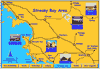
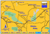
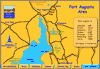
Maps
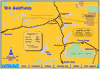
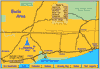
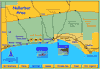
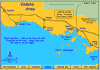
“If there is any road not previously travelled, then that is the one I must take.”
Edward John Eyre, 1841
In the spirit of the early explorer Edward John Eyre and his aboriginal companion Wylie, the Nullarbor Net Crew hopes that our practical and local experience helps you to enjoy your transcontinental journey.
Trip Planners
Western Australia Trip Planner
For driving distances across Australia from Darwin, Broome, Monkey Mia, Kalbarri, Perth, Margaret River or Albany to the Nullarbor and beyond.

Eastern Australia Trip Planner
For driving distances across Australia from Darwin, Cairns, Brisbane, Gold Coast, Sydney, Canberra, Griffith or Melbourne to the Nullarbor and beyond.

Check out Nullarbor Traveller
Adventure Travel — at its best!